
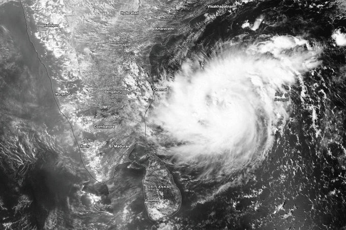
Bay of Bengal Cyclone Alert: Storm Likely by November 16, Odisha and Andhra Pradesh on Watch
A developing weather system over the Bay of Bengal is likely to intensify into a cyclonic storm by the evening of November 16, prompting the India Meteorological Department (IMD) to issue warnings for fishermen and alert coastal states about possible heavy rainfall and strong winds.
The system, which formed as a low-pressure area over the Southeast Bay of Bengal, intensified into a well-marked low-pressure area by Saturday, November 14. It is expected to move northwestwards and develop into a depression within the next 24 hours before strengthening into a cyclonic storm over the central Bay of Bengal.
According to the latest tropical weather outlook, the system could intensify further into a severe cyclonic storm by November 18, with sustained wind speeds of 75–85 kmph and gusts reaching 95 kmph. However, this remains a forecast and its actual intensity will depend on subsequent developments.
Odisha and Andhra Pradesh are among the regions being closely monitored. The Odisha government has alerted district administrations in coastal, northern and southern parts of the state. Disaster Management Minister Suresh Pujari said precautionary preparations had been initiated.
The IMD has forecast heavy to very heavy rainfall in isolated areas of Odisha on November 19 and 20. Coastal Andhra Pradesh could also receive widespread rainfall, with isolated very heavy showers possible in north coastal districts on November 19.
The Andaman and Nicobar Islands are likely to experience widespread rainfall between November 14 and 20, with isolated heavy rainfall during the initial days.
Squally weather is expected over the Andaman Sea and large parts of the Bay of Bengal, with wind speeds reaching 60 kmph initially. Stronger winds of up to 80 kmph are expected from November 17.
In view of rough sea conditions, the IMD has advised fishermen currently at sea to return to the coast by November 15 and warned them against venturing into the sea during the adverse weather period.
The system's eventual track and possible landfall location remain uncertain. The IMD is monitoring its movement and is expected to provide further updates as it intensifies.