
Heavy Rain Batters Hyderabad as City Records Near-100 mm Rainfall, Authorities on High Alert
A spell of intense monsoon rainfall accompanied by thunderstorms, lightning, and strong winds brought large parts of Hyderabad to a standstill on Monday evening, inundating roads, disrupting traffic, and triggering extensive emergency response operations across the city. The downpour, which lashed the city between 4:45 pm and 6:30 pm , delivered near-record rainfall within a short span, exposing Hyderabad's continuing struggle with urban flooding during extreme weather events.
According to rainfall data compiled by weather observers, Vinayak Nagar recorded the highest rainfall at 98.5 mm , making it one of the wettest locations in the city during the event. Other areas that witnessed exceptionally heavy rainfall included Bansilalpet (87.5 mm), Vittalwadi (79.8 mm), Basheerbagh (78.5 mm), Vidya Nagar (74.5 mm), Musheerabad (65 mm), Amberpet (57.8 mm), Adikmet (57.5 mm), Maredpally (57.5 mm), LB Stadium (55.5 mm), Miyapur (53.3 mm), Kukatpally (52 mm), Hafeezpet (47.5 mm), KPHB Colony (46 mm), and Shaikpet (44.5 mm).
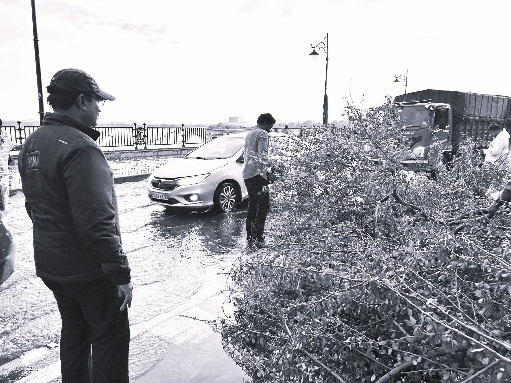
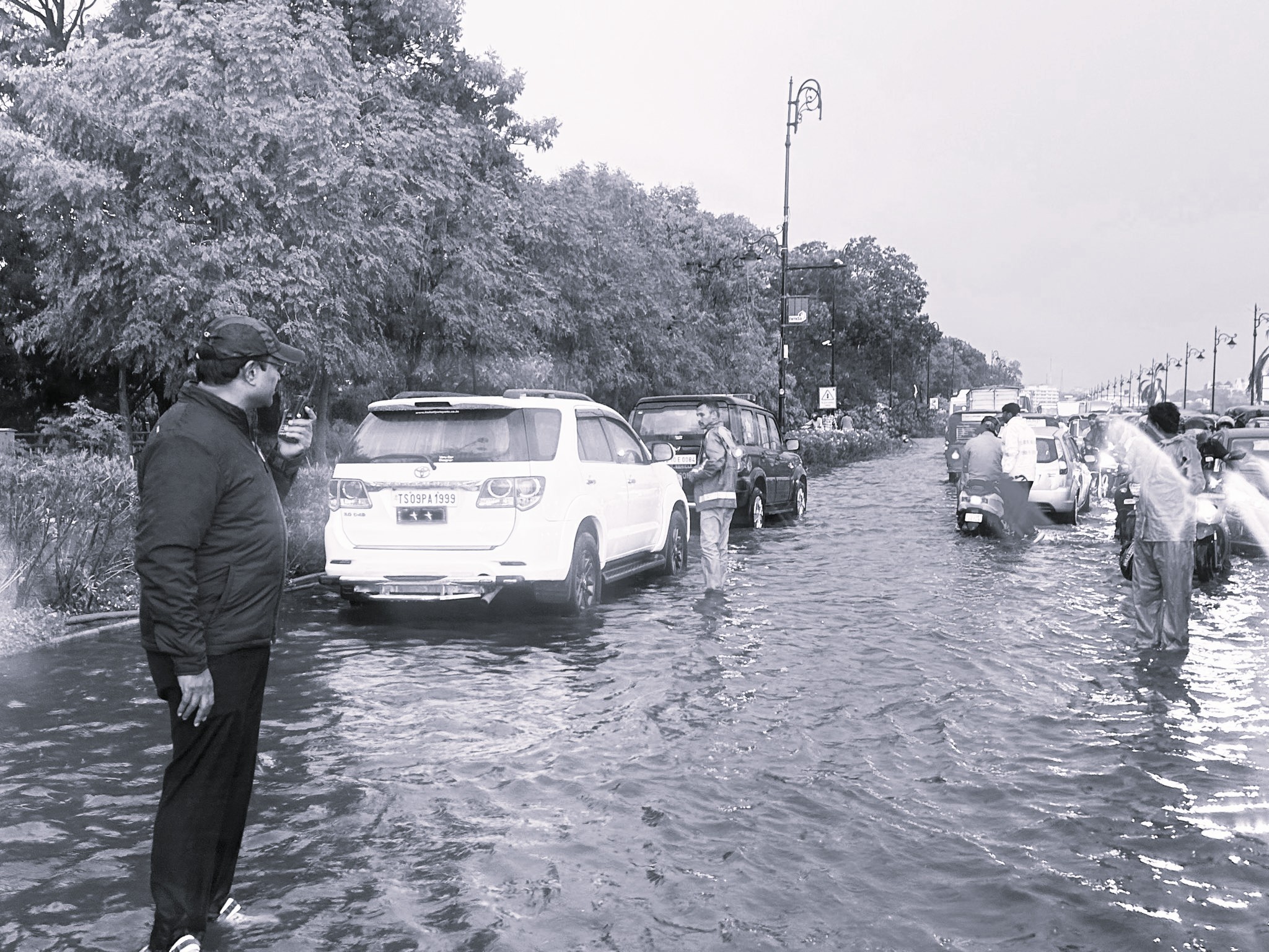
The heavy showers resulted in widespread waterlogging across several major roads and low-lying localities. Key stretches around Tank Bund , the Telangana Secretariat , Begumpet , Khairatabad , and parts of central Hyderabad witnessed severe traffic congestion as rainwater accumulated rapidly on road surfaces. In several locations, motorists and pedestrians were forced to navigate through knee-deep water, leading to significant delays during peak evening hours.
The situation became particularly challenging along the Secunderabad-bound stretch of Tank Bund, where floodwaters submerged portions of the roadway. Traffic movement was further affected after a tree collapsed on the carriageway, prompting immediate clearance operations and temporary diversions.
Responding swiftly to the situation, HYDRAA Commissioner A.V. Ranganath conducted field inspections and personally reviewed relief measures. Teams from the HYDRAA Disaster Response Force (DRF) were deployed across affected areas, including Serilingampally, Kondapur, Gachibowli, Shaikpet, Tolichowki, Madhapur, Secunderabad, Hyderguda, and Attapur . Emergency personnel worked through the evening to drain stagnant water, remove debris, and assist stranded commuters.
Officials reported that nearly 76 trees were uprooted or damaged across the city due to strong winds accompanying the storm. Municipal workers, disaster response teams, and traffic police coordinated efforts to clear roads and restore normalcy as quickly as possible.
The weather event comes amid an active phase of the Southwest Monsoon over Telangana. The India Meteorological Department (IMD) has forecast further spells of light to moderate rainfall accompanied by thunderstorms, lightning, squally weather, and gusty winds of up to 40–50 kmph across the state over the next few days. The weather agency has also issued yellow-watch alerts for several districts, warning of thunderstorms, lightning activity, and strong surface winds.
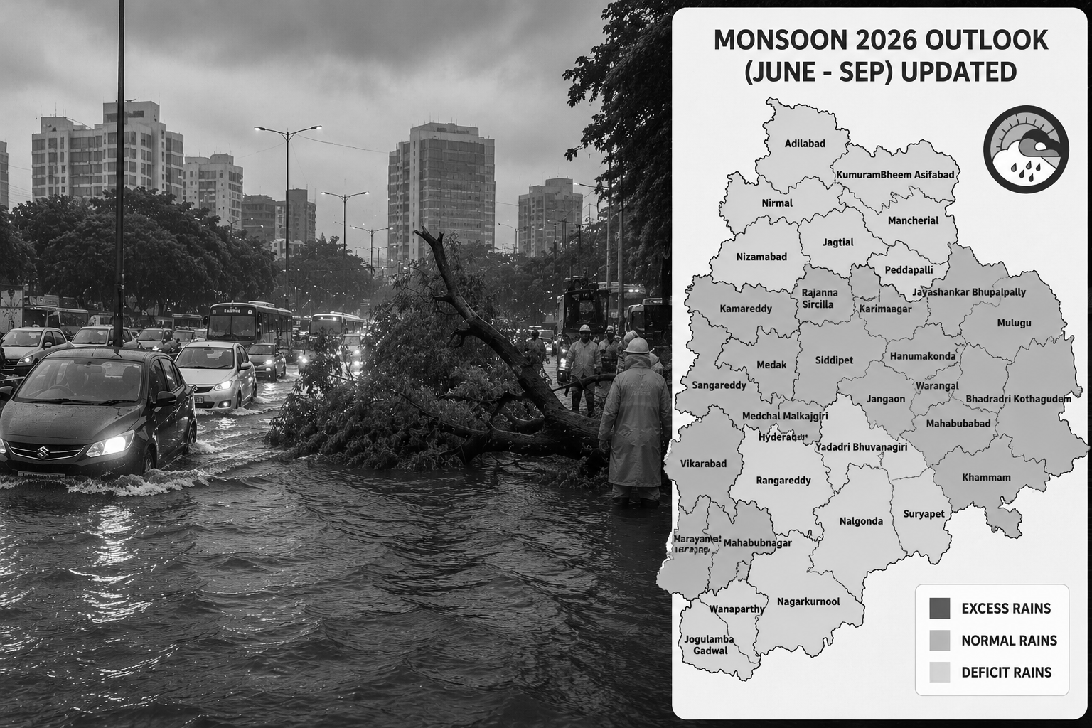
Interestingly, while Hyderabad witnessed nearly 100 mm of rainfall in less than two hours , longer-term projections suggest the monsoon season may not be uniformly wet. An updated Monsoon 2026 Outlook (June–September) released by Telangana Weatherman places Hyderabad, Rangareddy, Nalgonda, Suryapet, Nagarkurnool, Nizamabad, Adilabad, Mancherial, Peddapalli, and several other districts in the deficit rainfall category for the season. In contrast, districts including Sangareddy, Medak, Siddipet, Karimnagar, Hanumakonda, Warangal, Khammam, Bhadradri Kothagudem, Mulugu, and Jayashankar Bhupalpally are projected to receive normal rainfall . Notably, no district has been placed in the excess rainfall category.
The contrast highlights an increasingly common weather pattern in which short-duration, high-intensity rainfall events occur even during seasons forecast to receive below-normal rainfall overall. Experts say such episodes can place immense pressure on urban drainage systems and significantly increase the risk of flash flooding, traffic disruptions, and damage to public infrastructure.
While the rains brought welcome relief from the intense summer heat, they also served as a reminder of the growing challenges posed by extreme weather events in rapidly urbanising cities. With more showers forecast over the coming days, authorities have urged residents to remain vigilant, avoid unnecessary travel during heavy rain, stay away from waterlogged roads and exposed electrical infrastructure, and closely follow official weather advisories.